
FME has been around for over 25 years and counts thousands of users, but many geomatics experts still haven’t heard of this software. Trust us, once you’ve started using FME, there’s no going back. With one program, you can automate processes, transform data, and integrate multiple sources and systems with your GIS application—but that’s not all!
Read on for five more reasons to add FME to your toolbox.
1. Say goodbye to repetitive tasks
Sick of repetitive manual data processing and production tasks? With FME, you can automate an impressive number of low-value tasks to really put your knowledge to work and spend more time focusing on spatial analysis. Sit back and relax while FME converts data from CAD to GIS, publishes to ArcGIS Online, downloads data from an application or website, automatically links data to multiple Excel files, and more.
2. User friendly and easy to learn
FME is a no-code or low-code solution that gives you the power of programming and database scripts with no need to learn a programming language (Python, Java, C++, SQL, etc.). Most tasks in FME can be done using pre‑set transformers. Plus, there’s an entire library of free online documentation, examples and tutorials available to support you.
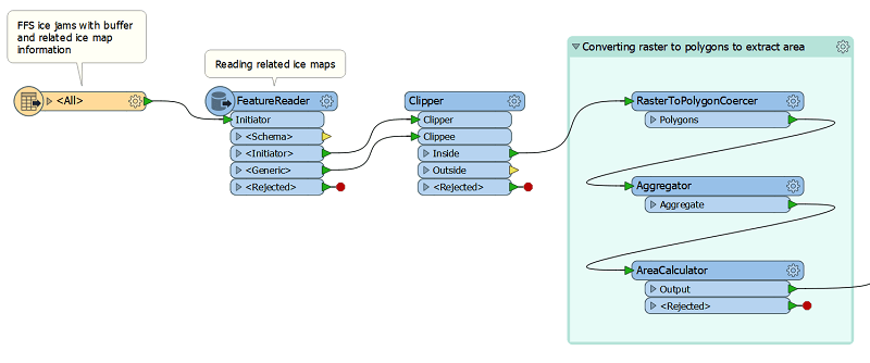
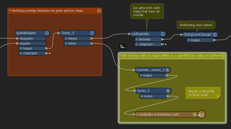
FME’s drag and drop interface makes for a streamlined user experience. With colour-coding and bookmark options for easy process documentation, it’s simple to follow the sequence of processes and emphasize complex or sensitive components—an important feature when changing a process or migrating to a new version.
3. A versatile solution
One of the challenges of being a GIS specialist is working with multiple datasets and, often, multiple different data formats. With FME, you’ve got options! It supports over 450 different formats, including SHP, SQL databases, Excel, Access, rasters, Lidar, text, XML, JSON, and more! Plus, with the built-in visualization tool (FME Data Inspector), you can consult and view datasets for all of these formats directly in FME—no need to open five different programs just to see your data. And if a data format is not supported or your dataset is stored in another program, FME can access it through an API (application programming interface). FME allows HTTP requests and can interact with an external application if it has an open API.
4. Performance and adaptability
Offloading your repetitive tasks to FME doesn’t just save time; it also means your bosses and partners will have their data in hand faster than ever. What a GIS specialist can do in a week, FME can do in just a few seconds, minutes or—at most—hours. Generally, high‑volume jobs take only a few minutes, depending on data volume, network traffic and how quickly third‑party applications can send and receive a high volume of data.
FME scripts are also easy to edit when you change data sources or models, so you can rest easy knowing you’re not locked into your initial choices. Simply swap out the input or output elements as needed—no need to edit the core process.
5. Limitless possibilities
Though programming knowledge is by no means a prerequisite for using FME, you can still integrate your own scripts or code (like Python) to add new functionalities or optimize processes. Judging by our customers’ experiences, your only limit is your imagination.
Experienced users build prototypes in FME to quickly validate their ideas or run feasibility tests. In the past, users had to run a full workspace to see the results of their tests (in the written dataset or with the Data Inspector). With the addition of the cache and partial workspace run functionalities, it’s now quicker and easier than ever to test out concepts and approaches.
The right solution for an evolving field
Powerful, flexible and easy to use, FME is the go-to tool for any GIS specialist in a world where spatial information is increasingly important.
With no programming knowledge, GIS analysts can automate mundane tasks so they can get data to internal and external stakeholders fast and focus on value-added analyses and tasks that improve their organizations’ services.
Plus, you’ll have peace of mind knowing that your processes and automations can adapt to new industry standards and your organization’s changing needs. With FME, who knows how far you’ll go?
Becoming a GIS ninja is within your reach, and we can help you get there!