
Address data is an important asset for any municipality, county or government agency. It may seem simple enough to manage, but the truth is that these datasets can be trickier than they seem, due both to their volume and to the type of information they contain. There is more to an address than just a number, a street name and a postal code. It is also tied to a location, which needs to be placed as precisely as possible.
Who uses address data?
There are several departments in a city that directly and indirectly use address data. For example, the planning and development department has to oversee the development of new neighbourhoods, which requires the creation of new addresses, the postal service has to deliver mail and packages to the right recipients, the tax department has to issue statements to property owners, and police and fire departments use address data to respond to emergencies.
What does address data look like?
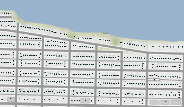
In both geomatics and mapping, address data is usually depicted as a series of dots or points. Each dot represents the address of the property on which it is located. Depending on what the data is used for, the dot may be located in the centre of the lot (centroid) or closer to the street with which it is linked.
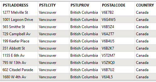
An attribute table that is linked to map points usually contains any useful information connected to the address, such as the street name and number and the postal code. It also contains information for internal use, such as when it was last updated and a unique identifier. If paired with property assessment data, you can also attach the property owner’s name, roll number, the year of the building’s construction, zoning, etc.
What is spatial validation?
Spatial validation ensures that data is accurately represented in space. Validation means confirming that the location is correct and that the geometric shape, dimensions and relations to surrounding entities conform to reality. For address coordinates (points), you’ll want to validate the location as well as the relation in space to surrounding entities, such as confirming that the distances to streets and other address points are accurate.
Spatial validation complements the process of validating attribute data, in which the organization verifies that the non-spatial data associated with the address is accurate and that it adheres to a pre-defined standard (street name and number, postal code, etc.), along with verifying any other meaningful characteristics that the organization wants to validate.
Why does it matter?
Emergency responders such as firefighters and the police depend upon precise data and locations. A single location error could send emergency responders to the wrong location, wasting precious time. For other city services, incorrect or poorly positioned data can negatively impact residents and cause delays and additional costs when updating internal systems.
A solid testing strategy is key
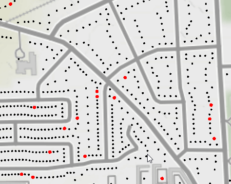
Validating address data can reveal all kinds of problems. To identify them, data has to be tested in different ways to get a clear picture of the situation. As issues are corrected, data quality goes up and users can make decisions more confidently. Here are some examples of questions that have to be answered when validating spatial data:
- Are any address points missing (compared to taxation data or other systems)?
- Are there any overlapping address points?
- Are there duplicates?
- Are addresses represented by a shape other than a dot (small circle for example)?
- Is the address next to the right street?
- Is the address point on the right side of the street?
- Do the address points appear in the right order?
- Do the address points fall within the city limits?
Improving your data
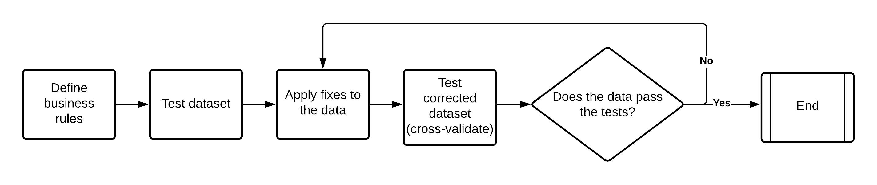
The first thing to do is to determine the standard of quality required for your spatial data. Identify precisely which types of errors must be corrected and which are tolerable, and set priorities for handling problems. With clear business rules, it is much easier to create geomatics tests that can query data and paint you a clear picture of the situation.
ETL to the rescue
ETL is a powerful tool that lets you easily create and run testing procedures. You can use software such as FME to quickly query the data and automatically extract the information you want. You can also generate custom reports with a detailed list of the necessary corrections, along with a map showing the address points that need correcting.
What next?
It’s never too late to improve the quality of your address data. If you do not know what kind of data quality you’re working with right now, you should run some tests to get a better idea and identify any shortcomings. If all’s well, you won’t have too many errors, and they’ll be quick and easy to fix. Worst case scenario, you’ll know exactly what you’re looking at. You can then make a step-by-step plan to correct any errors and, at the end of the process, your organization, colleagues and residents will be able to rely on data that’s more accurate than ever.
Need assistance building a strategy to validate and correct your address data?