Move faster…
and in the right direction
From giving you strategic advice to carrying out your GIS projects, our experts will be there to ensure the success of your department.
STRATEGIC ADVICE
We can advise you on solution architecture, project analysis and how
to draw up a skills
improvement plan.

TURNKEY PROJECTS
Are you short on time or resources? We take care of your projects from end to end. Our experts never shy away from a good challenge.
Geospatial performance is yours for the taking
Our solutions are modular, complementary and based on a collaborative approach. Improve the skills of your team and boost the performance of your ArcGIS environment, one project at a time.

Ignition
Automation

Orchestration

FME Governance
Ignition
Automation
Orchestration
FME Governance
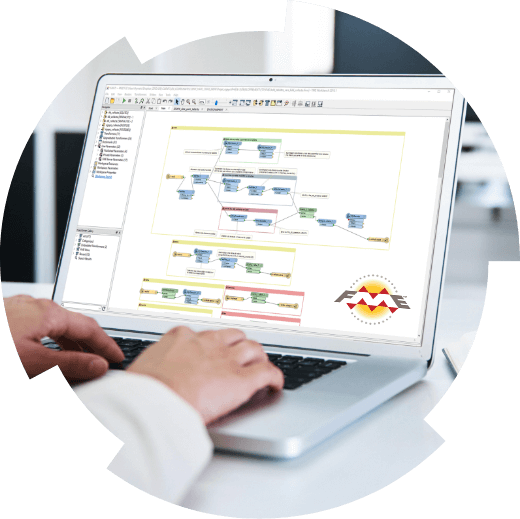
NOTHING BEATS FME
AS A GEOSPATIAL DATA PROCESSING AND INTEGRATION SOLUTION
Safe Software’s FME platform is the choice of countless experts because it is the best technology on the market for getting the most out of your geospatial data
- Focus on value-added tasks thanks to automation
- Achieve unparalleled efficiency without having to code or depend on IT
- Break down your internal silos by integrating your systems and applications
- Optimize your ArcGIS environment

Our experts’ blog
Lights on geospatial performance
Consortech: 35 years of geospatial performance
Since 1989, at the heart of our mission: to help GIS leaders in leveraging their geospatial data for the benefit of their organization and community.

SUCCESS STORY
Flying colours for our team
Portland Public Schools: from CAD Data to ArcGIS to IBM TRIRIGA
How Portland Public Schools achieved an 80% time reduction without a single line of code!